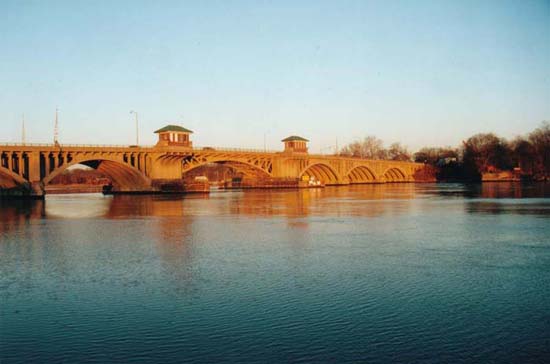
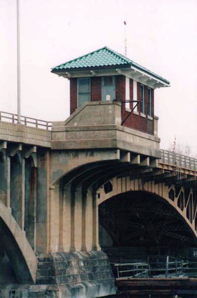
The Washington Bridge is highly unusual in that it combines open-spandrel arches with an opening portion that allows navigation on the river channel. The open-spandrel design gives the bridge an elegant appearance, especially since the leaves of the deck-girder bascule are arched so as to be aesthetically compatible with the fixed spans. The arches each consist of six parallel ribs, from which columns rise to support the floor beams for the roadway. The roadway is 43' wide and originally accommodated two streetcar tracks as well as vehicular lanes and pedestrian sidewalks. Decorative flourishes include the shaping of the floor beam ends as Classical modillions, arched openings between columns, concrete parapets with recessed arched panels, and two small tile-roofed brick buildings that originally served as the operators house and a public comfort station.
When the Connecticut Highway Department was given authority over major bridges in 1915, the Department's engineers immediately turned their attention to U. S. Route 1, the state's busiest "trunk line" and the principal route into New England from New York City. Planning for a bridge to replace the old and narrow swing bridge across the Housatonic River at this site began in 1915, but shortages of steel associated with World War I delayed completion until 1921. At the time, the Washington Bridge was the state's most expensive bridge project ($1.5 million), and it was considered a showcase of the Department's engineering expertise. Today the bridge retains much of its original appearance; the only major change is the modern tubular guardrail that supplements the arches' parapet and replaces the bascule's original ornamental iron railing.
Take a look at the original Connecticut Highway Department drawing for this bridge.