|
|
The Thomas Daniels Site was discovered in the course of archaeological surveys that accompanied the Connecticut Department of Transportation's reconstruction of Exit 81 off of Interstate Route 95, at the junction of Cross Road in Waterford, Connecticut. The highway-reconstruction project involved eliminating the existing ramps and constructing new ramps, and the Cross Road overpass was lengthened and widened.
Because the project used federal funding, it had to comply with the National Historic Preservation Act, which mandates identification of and mitigation of impacts to significant archaeological and historical resources. In accordance with the Act, before any construction began, the State Historic Preservation Office reviewed the project and determined that it possessed archaeological sensitivity, recommending that a professional survey be conducted to identify any possibly significant archaeological resources in the project area.
The archaeological survey was conducted in phases. In Phase I, or reconnaissance phase, undertaken in 2000, a grid was laid out over the area that would be impacted by the highway project. Shovel test pits were excavataed at 15-meter intervals along the grid. A cluster of test pits yielded sizeable quantities of 18th-century household-related artifacts: hand-forged nails, fragments of ceramics, pipestems, shell, and bottle glass. The date, type, and density of artifacts suggested a possible buried colonial-period house site. Basic historical background research was conducted as part of the Phase I, which established the project area as settled relatively early, but there was not specific-enough information to pinpoint the location of a house. The site was given a number in the statewide archaeological database, Site 152-128.
Phase II was designed to evaluate the significance of Site 152-128 using the eligibility criteria of the National Register of Historic Places, Criterion D of which recognizes properties that have yielded, or may be likely to yield, information important in prehistory or history. A 5-meter-interval grid of test pits was laid over the concentration of 18th-century materials discovered in Phase I. Over 700 additional artifacts--ceramics, nails, glass, and food remains--were recovered, strongly suggesting that the site was the location of an early 18th-century homestead. The site was also determined to have excellent stratigraphic integrity, meaning that it had been relatively unaffected by modern ground-disturbing activities, despite being located next to a highway embankment. In the Phase II, intensive historical background research was undertaken to link the site with specific individuals. It was at this point that the site was determined to be the house built by Thomas Daniels. It was recommended that Site 152-128 be considered eligible for listing on the National Register of Historic Places.
|
|
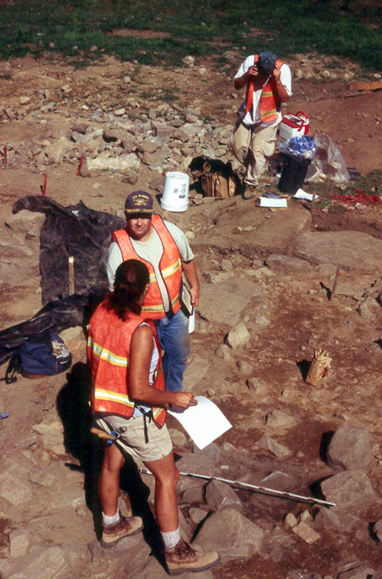
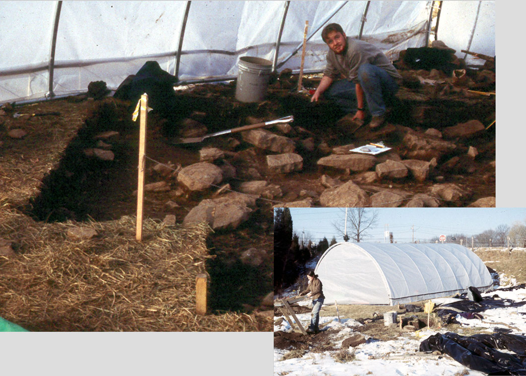
The Data Recovery began in the winter and so required the archaeologists to work inside an all-weather shelter, which was moved around the site as excavation progressed. |
As a consequence of this recommendation, the Connecticut Department of Transportation evaluated alternatives to impacting the site
but found that there was no realistic design that could avoid its destruction:
the site extended the full width of the planned new roadway loop and was bounded on all sides by wetlands.
It was determined that the impacts to the site would be mitigated by conducting a Phase III archaeological excavation,
also known as data recovery.
Although the site itself was destroyed by the data recovery,
because it was removed by professional archaeologists, the essence of the site,
its historical information, was preserved.
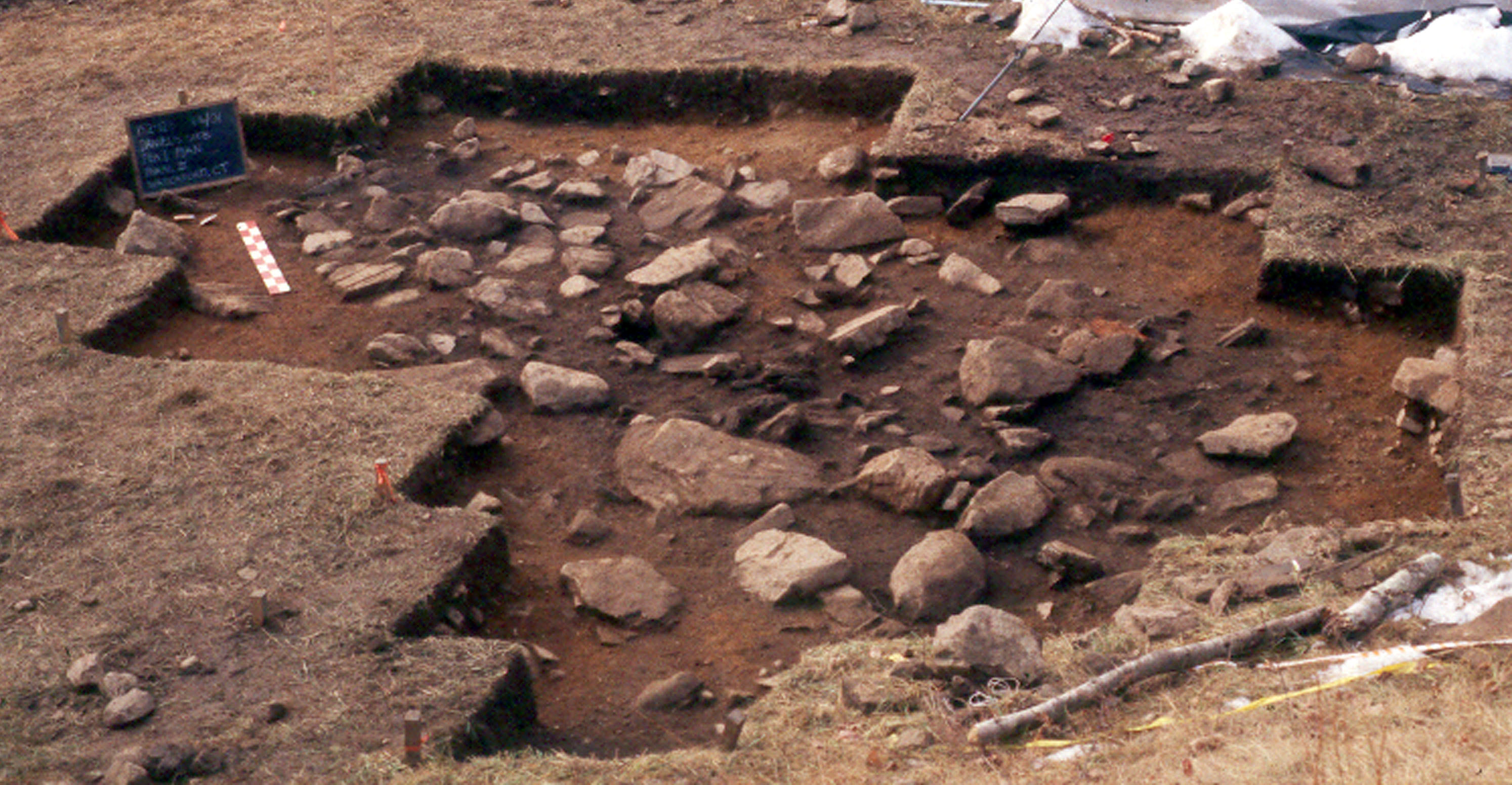
More than 73,000 artifacts were recovered, and a cellar,
food-storage pits, hearth site, and numerous
post holes were exposed. Data recovery produced hundreds of photographs,
site maps,
and drawings, as well as a
database that allowed
statistical analysis of artifact distributions across the site.
This information permits the reconstruction of the architecture and lifeways of
the Daniels homestead.
|
In the Data Recovery phase, the site was excavated in a series of one-meter (39") squares. The soil was removed in 10 to 20 cm (4-8") levels and screened through 1/8-inch mesh so as to recover very small artifacts and ecofacts. Hundreds of soil samples were taken from the site to the archaeological laboratory, where a water-flotation procedure allowed the recovery of even smaller items, such as seeds. |
|
|
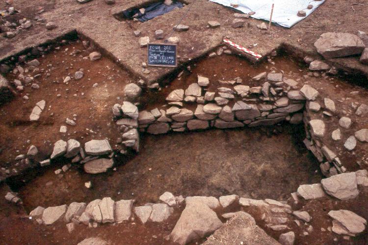
In addition to recovering artifacts and ecofacts, the Data Recovery documented numerous features, such as this stone-lined cellar to the house that stood on the site throughout much of the 18th century. |