|
|
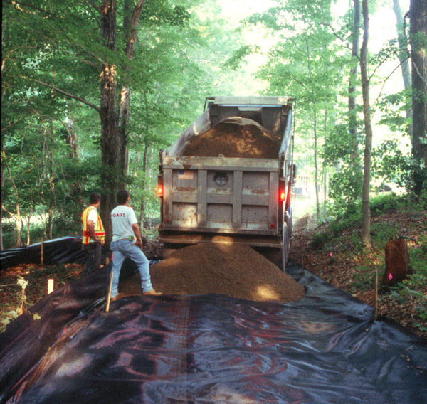
| Placement of construction fabric over the site |
Two basic strategies were developed to avoid or lessen damage to the archaeological sites located during the Canterbury wetland survey. Two sites located within and along the farm road/access road were threatened by the weight of the heavy equipment that would roll over them repeatedly to construct the floodplain wetland. To minimize this type of damage to these sites, a special construction fabric called Geotextile was placed on the farm road surface and covered by 12 inches of gravel. This method has been shown to effectively minimize soil compaction to sites and it protects artifact-bearing soils from the weight and vibration of construction vehicles.
On the floodplain, three sites were identified, one directly within the new wetland area and two near it. The creation of the new wetland required the excavation and removal of topsoils which would then be spread over the floodplain. The archaeological site within the new wetland area was much too large to preserve in place, and because virtually the entire floodplain is archaeologically sensitive, there was no alternative location for the wetland that would not impact significant archaeological sites. PAST therefore designed an archeological mitigation program in which the northern edge of the wetland site was preserved in place and the remainder of the site was tested very intensively. After the testing, archaeologists observed the wetland construction topsoil to ensure that no subsurface remains such as cooking hearths were destroyed by the project, and artifacts were collected and recorded as the topsoil was removed by a machine.
It was impossible to collect every artifact from the wetland site as the topsoil was removed by machines during the project construction. However, because the artifact-bearing topsoil was to be spread over the rest of the floodplain, PAST made sure to record and map exactly where the wetland site soils were placed. So that future archaeologists are not confused or misled by the moving of artifact-bearing soil from one site to two others, all three sites and the soil distribution were very carefully documented.
The five archaeological sites found in the Canterbury wetland survey have been designated as a Connecticut State Archaeological Preserve: the Quinebaug River Prehistoric Archaeological District. Status as a Preserve ensures that these important sites will be permanently protected.