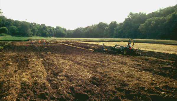
The sites were discovered when the Connecticut Department of Transportation decided to create a wetland on the Quinebaug River floodplain to replace wetlands that were impacted by nearby road improvements nearby. Because the road improvements involved federal funding, the project must comply with the National Historic Preservation Act (NHPA). This act mandates that significant archaeological and historical resources be identified and that project-related impacts to such resources are avoided if at all possible. Thus, an archaeological survey was conducted to identifiy potentially significant resources before the new wetland was built. The survey was undertaken by the professional archaeologists of Public Archaeology Survey Team, Inc.(PAST)of Storrs, Connecticut.
The survey began with research into local and regional history and prehistory to find out what was known about the project area and its vicinity. Research was also done to gather information about natural features known to be associated with prehistoric sites. PAST's research strongly suggested that both the access road terrace and floodplain wetland areas were likely places of prehistoric Native American use for thousands of years. The river provided water and food – fish, waterfowl, and mammals – and a transportation route for trade and communication with other people in all directions through its tributaries. Following the background research, archaeologists walked over the project area, looking for above-ground evidence of historic-period occupation, such as foundation remains, and environmental features that were likely attractive to prehistoric people. PAST found no areas of obvious disturbance in the walkover inspection of the project impact area. We therefore conducted Phase I Reconnaissance Survey testing of the access road and floodplain wetland creation area to look for archaeological evidence of Native American occupation.
|
|
| Archaeologists looking for artifacts on the ground surface in Canterbury |
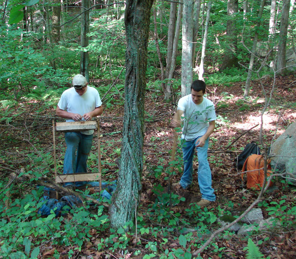
Unlike some areas of the United States, such as the Southwest, where artifacts thousands of years old can still be found lying on the surface, prehistoric sites in New England are nearly all buried beneath the ground surface. The only way to find such sites is by digging for them. Shovel test pits measuring approximately two feet by two feet in plan were excavated by hand using shovels and trowels. Test pits were dug by natural soil layers (or strata), until glacial sediments (or in some cases the water table) were reached. All excavated soil was passed through Ľ-inch mesh screens in order to recover very small artifacts. All artifacts were collected from the screens, and their location (provenience) information and basic descriptions were recorded. The soil horizons (stratigraphy) and characteristics of each test pit were also recorded to allow for more detailed analysis and interpretation of the existing soil conditions. It is important to note that archaeologists spend as much time filling out paperwork to document their finds as they do digging!
The majority of test pits were placed along parallel straight lines (linear transects) spaced about 30 feet apart. This method of testing provides an even sample of the tested areas. The test pits represent a sample of what might be found in an area because they uncover only a small proportion of what is actually buried in the ground; but, the sample provides archaeologists with the information needed to estimate what else might be in the ground in a given area. The initial phase of testing, or Phase I Survey, required the excavation of 115 test pits. Thirty of these contained artifacts, and seven prehistoric sites were identified. An archaeological site is defined as an area where human activity once took place.
|
| Archaeologists digging shovel test pits |
After the first phase of investigations was completed, the seven sites were further investigated in a Phase II survey. This level of survey is site-specific and is designed to determine the size, age, function and importance of a site. To do this, test pits are excavated over a site along a grid pattern at 15-foot intervals. This close-interval testing provides a much better picture of what the site is really like (is it a large, complex village, or a small hunting camp?). Phase II archaeological testing is a lot like playing the game Battleship™. Sometime you hit something, and sometimes you don’t. In archaeology, the “hits” will form a pattern that identifies the overall shape of a site. At the same time, a sufficient sample of the site will be obtained to figure out what happened, and how long ago it happened.
If a site is found to contain artifacts that may significantly help expand the knowledge of prehistory, it may qualify for listing in the National Register of Historic Places, and may be important enough to preserve permanently. During the Phase II archaeological survey, 640 test pits were excavated. Over 200 of these (about a third) contained artifacts. Based on the Phase II survey, five of the seven sites identified were determined to meet the criteria for inclusion in the National Register of Historic Places, and were also determined to warrant designation as a State Archaeological Preserve. The sites’ listing on the National Register is an honorific recognition, denoting their importance to our understanding of our local, state and national history, but providing little protection. Their designation as a State Archaeological Preserve, on the other hand, provides permanent protection against damage or destruction.